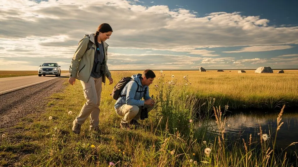
The Canadian Prairies can seem endless from behind a windshield. The highway runs straight, fields stretch toward the horizon, and the next town might appear to be the only reason to stop. Yet across Manitoba, Saskatchewan and Alberta, some of the most rewarding travel experiences begin precisely where the obvious attractions disappear.
A roadside wetland alive with birds, a grassland trail revealing the contours of an ancient landscape, a mural on a quiet main street or a sunset above an open valley can turn a long driving day into something memorable. None requires a packed sightseeing schedule.
The trick is to stop looking exclusively for major landmarks and start noticing how the landscape, communities and sky change along the route. That shift also calls for practical planning: distances can be deceptive, remote roads deserve respect, and the best viewpoints are those you can access safely.
Whether crossing the Prairies on the Trans-Canada Highway or exploring quieter secondary roads, a few thoughtfully chosen stops can change the character of the entire journey.
Prairie road trips: the essentials
- Choose three different experiences: a natural landscape, a small-town cultural stop and a scenic viewpoint.
- Refuel before remote detours, verify road conditions and never assume that a promising roadside location is publicly accessible.
- Use the changing light, local stories and night sky to make the journey meaningful without chasing distant attractions.
- Why Do the Prairies Feel “Endless” and How Do You Make Them Interesting?
- How to Build a Prairie Stop Day With 3 Anchors in Under 6 Hours?
- What Should You Choose in the Prairies: Grasslands, Small-Town Events, or City Museums?
- The Backroad Mistake in the Prairies That Can Leave You Without Fuel for 120 km
- When Is the Best Time to See Big-Sky Sunsets in the Prairies Without Chasing Storms?
- How to Choose a Safe Prairie Sky-Viewing Spot Without Trespassing or Getting Stuck
- Why Is the Most Interesting Public Art in Canada Often Outside the Main Tourist Core?
- How to Plan a Prairie Night-Sky Experience When the Moon Can Ruin Visibility?
Why Do the Prairies Feel “Endless” and How Do You Make Them Interesting?
The Prairies feel endless because their broad horizons offer fewer obvious visual landmarks than mountains, forests or dense cities. That does not make the landscape empty. Its interest lies in smaller changes: native grasses, wetlands, glacial features, river valleys and wildlife. Learning to notice those details transforms a seemingly monotonous drive into active exploration.
From highway speed, agricultural fields and open grasslands can blend into one continuous scene. But the Canadian Prairies are not uniformly flat. Saskatchewan’s Grasslands National Park, for example, contains rolling hills, deep coulees, ravines and the distinctive terrain of the Killdeer Badlands. These features are described in Parks Canada‘s nature and science information for Grasslands National Park.
The distinction between farmland and native prairie also matters. A cultivated field reflects an agricultural landscape shaped by human activity, while remaining native grasslands support ecological relationships that can be difficult to appreciate from a moving vehicle. Both can tell a story, but they invite different kinds of observation.
A useful way to approach any suitable stop is to identify three visual signals before leaving the vehicle:
- A colour or texture change: taller seed heads, darker vegetation in a depression or different grasses along a slope.
- A natural feature: a wetland, exposed rock, shallow valley or change in the shape of the horizon.
- A human trace: a grain elevator, fence line, old railway alignment or agricultural building revealing how people use the land.
Once safely parked at a legal access point, spend five minutes exploring what each signal might reveal. This is an observation exercise rather than a scientific rule. It creates a reason to look closely instead of taking one photograph and immediately returning to the highway.
There is also a difference between seeing grassland from the road and walking along an accessible trail. Even a short walk may reveal birdsong, insects, changes in the ground and subtle variations in vegetation that are difficult to detect inside a vehicle. Stay on designated paths where required and respect protected habitat.
You do not need specialist equipment. A camera, binoculars or simple curiosity may be enough. These activities are particularly useful for travellers who want an experience without booking a tour, provided the chosen site is open and accessible.
Once that approach becomes familiar, the next challenge is choosing enough stops to make the day interesting without turning the road trip into a race.
How to Build a Prairie Stop Day With 3 Anchors in Under 6 Hours?
Build a six-hour Prairie stop day around three contrasting anchors: a natural area in the morning, a small-town cultural experience at midday and a scenic viewpoint later in the afternoon. Allow time for driving, walking, food and unexpected delays. The aim is not to visit as many places as possible, but to experience three different aspects of the region.
This approach works because repetition, rather than distance alone, can make a driving day tiring. Three similar viewpoints may begin to feel interchangeable. A grassland walk followed by a local museum and an open-horizon lakeshore introduces changes in activity, scenery and pace.
Here is an illustrative six-hour framework. It is a planning template, not a verified itinerary between specific attractions.
| Time allocation | Anchor | Experience |
|---|---|---|
| 75 minutes | Natural site | Short trail walk, landscape observation and photography |
| 45 minutes | Travel | Drive toward a nearby community |
| 90 minutes | Small town | Lunch, main-street walk and a local cultural stop |
| 45 minutes | Travel | Continue to a scenic location |
| 45 minutes | Scenic viewpoint | Explore a lookout, lakeshore or river-valley viewpoint |
| 60 minutes | Flexible buffer | Unexpected stops, slower roads or additional exploration |
The suggested travel times are hypothetical. Actual driving distances must be checked for the specific route, and the six-hour limit may require adjusting or replacing stops. A seemingly nearby attraction can involve a substantial detour along secondary roads.
Start with an accessible natural site in mid-morning, when walking can be the day’s most active experience. Reserve midday for a community where food and shelter are available. Finish with a viewpoint selected for the direction of the light, ideally without leaving the main route too far behind.
This sequence can be adapted to a Manitoba wetland and nearby heritage town, a Saskatchewan grassland corridor or an Alberta prairie river valley. It should not be treated as a fixed cross-province itinerary.
The final anchor need not coincide with sunset. In summer, sunset may fall too late for a six-hour daytime plan. The goal is simply to finish somewhere worth spending time rather than at another fuel pump.
Choosing the right anchors depends on whether the priority is solitude, human connection or understanding the region’s history.
What Should You Choose in the Prairies: Grasslands, Small-Town Events, or City Museums?
Choose grasslands for immersion in nature, small-town events for community life and city museums for historical and cultural context. Each delivers a different experience. Travellers with limited time often benefit from combining one weather-dependent outdoor stop with one more predictable cultural attraction rather than relying on a single type of activity.
Grassland parks reward people interested in walking, birds, ecology and open space. Their appeal depends partly on season, weather and access. Some trails can be uncomfortable in extreme heat or difficult to reach after rain, while wildlife activity varies throughout the day.
Small towns offer a different perspective. A local museum, community fair, mural or historic main street can explain how agriculture, transportation and local traditions have shaped a particular place. Meaningful encounters are possible, but an event should never be assumed to be taking place without checking the community calendar.
Prairie cities such as Winnipeg, Regina and Saskatoon provide opportunities to explore regional history, Indigenous perspectives, arts and science through established cultural institutions. Museums are particularly useful when outdoor conditions are unfavourable, although their exhibitions and opening schedules also require confirmation.
| Factor | Grasslands | Small towns | City museums |
|---|---|---|---|
| Best suited to | Nature, solitude, walking | Community, heritage, public art | Learning, interpretation, exhibitions |
| Weather dependence | High | Moderate, depending on activity | Generally lower indoors |
| Planning required | Access, trails, conditions | Event dates and business hours | Admission and opening hours |
| Ideal travel style | Flexible outdoor exploration | Unhurried road-trip stops | Planned cultural visits |
For a short transit day, a small town close to the highway may be the easiest option. For a longer stay, a protected grassland landscape can justify more exploration. A museum visit can provide context before heading into rural areas, especially for travellers unfamiliar with the region.
Is a small town worth a detour? Sometimes, but the answer depends on what is actually there and how much time the detour requires. A documented heritage district, operating local museum or community event offers a stronger reason than a vague promise of small-town charm.
The most satisfying combination often includes both landscape and people. A grassland stop shows the physical setting; a community visit helps reveal the lives and histories connected to it.
Whichever experience you choose, reaching rural attractions safely matters as much as choosing worthwhile destinations.
The Backroad Mistake in the Prairies That Can Leave You Without Fuel for 120 km
The biggest Prairie backroad mistake is assuming fuel, mobile coverage and reliable road access will remain available after leaving the main highway. A 120–kilometre gap between fuel stops is a planning scenario, not a universal Prairie distance. The real risk depends on your chosen corridor, service-station hours, vehicle range and road conditions.
Across remote parts of southern Saskatchewan and other Prairie regions, secondary roads can connect communities separated by long stretches of farmland or grassland. Some villages have limited services, and a station shown on a map may not be open when you arrive.
The consequences become more serious on gravel roads. Reduced speeds increase journey time, rough surfaces can change vehicle efficiency depending on conditions, and rain may turn an otherwise manageable route into a difficult one.
Conditions around Grasslands National Park illustrate why advance planning matters. Parks Canada’s planning information for Grasslands National Park warns that access involves gravel roads, some roads may become impassable when wet, cellular service is intermittent and GPS directions can be inaccurate.
These warnings apply specifically to the park and surrounding region, not automatically to every rural road in Manitoba, Saskatchewan or Alberta.
Before making a detour, identify the last confirmed fuel station, the next confirmed station and the additional kilometres required if a road becomes unsuitable. Use mapping tools and available service-station information, but check operating hours rather than treating a map marker as proof of availability.
A short scenic detour generally requires checking fuel and road access. Travelling extensively on the rural grid-road network demands greater self-sufficiency, including navigation alternatives, suitable supplies and a plan for delays. In winter, additional weather and road-closure risks make spontaneous remote-road exploration especially inadvisable.
Five checks before leaving the main Prairie highway
- Confirm fuel availability: record the last and next confirmed stations, their opening hours and the route distance between them.
- Check your vehicle’s range: establish that the available fuel comfortably covers the proposed journey and a reasonable detour.
- Save navigation offline: download the route and record an alternative way back to a major road.
- Prepare basic supplies: confirm that drinking water, seasonally appropriate warm clothing and essential vehicle equipment are onboard.
- Share your route: send your intended roads and expected return or arrival time to someone who can act if you fail to check in.
There is no single safe fuel reserve that suits every vehicle and road. The useful margin depends on actual consumption, terrain, weather and the possibility of retracing the route.
Once travel logistics are under control, the wide horizon becomes an advantage, especially as the afternoon light begins to change.
When Is the Best Time to See Big-Sky Sunsets in the Prairies Without Chasing Storms?
The most practical time to enjoy a Prairie sunset is during roughly the hour before local sunset, from an accessible viewpoint with an open western horizon. Long summer evenings offer flexibility, while spring and autumn bring earlier viewing opportunities. Clear visibility, safe access and stable weather matter more than selecting one supposedly perfect month.
The Prairie landscape lends itself to sunset watching because open horizons allow low-angle sunlight to travel across grassland, farmland and valley slopes. As the sun drops, small features become more apparent: furrows cast shadows, grass heads catch light, and clouds can produce contrasting tones across the sky.
You do not need to drive toward a distant storm to see interesting light. A lakeshore, designated lookout or accessible river-valley viewpoint can offer rewarding views without adding unnecessary risk.
Choose a potential viewing location earlier in the afternoon. Check that it has public access, appropriate parking and a safe route back to the highway. Avoid discovering an unfamiliar gravel turnoff for the first time after dark.
Weather conditions deserve particular attention. Environment and Climate Change Canada‘s lightning safety guidance recommends checking forecasts before outdoor activities and identifying suitable shelter.
If you hear thunder, seek shelter immediately inside an appropriate enclosed building or fully enclosed metal-roofed vehicle. An open picnic shelter is not adequate protection. Remain sheltered for at least 30 minutes after the last thunder.
A dramatic sky is not a reason to ignore weather warnings. A sunset stop should be abandoned when thunderstorms or other hazardous conditions threaten. Do not remain on exposed high ground or near fences for a photograph.
Season also changes the experience. Summer offers late sunsets and comfortable opportunities for extended travel, although insects and holiday traffic may affect some locations. Spring and autumn can bring earlier light and cooler evenings. Winter sunsets arrive much earlier, but short daylight hours, cold and road conditions require additional preparation.
For photography, try arriving before the strongest colours appear. This allows time to assess the horizon and enjoy how the landscape changes, rather than spending the entire stop positioning equipment.
A carefully chosen sunset viewpoint can also serve as a starting point for stargazing, but a place that is safe in daylight is not automatically appropriate after dark.
How to Choose a Safe Prairie Sky-Viewing Spot Without Trespassing or Getting Stuck
A safe Prairie sky-viewing location needs confirmed legal access, secure parking on firm ground, enough separation from traffic and a clear view of the sky. Public parks, officially designated viewpoints and organised astronomy sites are preferable to improvised stops beside rural roads. Never assume an empty field is public property or that a dry-looking shoulder can support a vehicle.
Large areas of the Prairies are privately owned or subject to agricultural leases and other access arrangements. A fence-free field or unused-looking track does not establish permission to enter.
Access rules vary by province, property type and land designation. The practical rule is simple: use clearly authorised public access, follow posted conditions and obtain landowner or appropriate land-manager permission when access is uncertain.
Roadside stopping requires equal care. Rural grid roads may have narrow shoulders, drainage ditches or surfaces that become soft after precipitation. A vehicle parked on seemingly solid ground can become immobilised if the shoulder is wet or rutted.
Never drive off the hardened surface to improve the view when ground stability is uncertain. If there is no safe, lawful parking area, continue to another location.
When assessing a potential site, consider these factors together:
- Legal access is confirmed for the intended time of visit.
- Parking is permitted and the vehicle can remain entirely outside the travelled roadway.
- The ground is stable, reasonably level and suitable for the vehicle.
- People can stand and move without exposure to passing traffic.
- The relevant parts of the sky are visible without trees, buildings or strong nearby lighting.
- A workable communication or emergency fallback plan exists if cellular reception is unavailable.
The best viewing direction depends on what you want to observe. An open southern or eastern horizon can be useful for particular astronomical targets, but no single direction is essential for every skywatching session.
Designated dark-sky locations, managed park viewpoints and astronomy-club events can remove much of the uncertainty. However, designation does not automatically guarantee unrestricted night access, open facilities or suitable roads. Confirm current conditions with the site operator.
Where facilities exist, use established parking and viewing areas. Avoid blocking agricultural entrances, service roads, emergency access or gates, even when the road appears deserted.
It is worth applying the same curiosity to towns along the route, where cultural discoveries are often easier to access than remote natural viewpoints.
Why Is the Most Interesting Public Art in Canada Often Outside the Main Tourist Core?
Small-town public art can be especially rewarding because it often reflects the history and identity of the community around it. Prairie murals, grain-elevator artworks and roadside installations can connect everyday places to agricultural heritage, local memories and cultural storytelling. Their appeal comes from context and accessibility rather than from being objectively more important than big-city art.
In major cities, public art competes for attention with architecture, attractions and busy streets. In a smaller Prairie community, a mural may be one of the most visible features on the main street, encouraging visitors to stop and consider its subject.
Across Manitoba, Saskatchewan and Alberta, public artworks can provide starting points for understanding local settlement, transportation, farming and community history. Some works also address Indigenous histories and perspectives. These subjects require care: a mural offers one interpretation, not necessarily a complete or authoritative account.
Look for information about the artist, commissioning organisation and historical context where available. If an artwork depicts Indigenous people or traditions, seek interpretation from the relevant Indigenous community or an appropriate cultural institution rather than assuming the image explains itself.
A simple public-art walk can fit into an ordinary road-trip break. After parking legally, explore the main street on foot and look for wall paintings, sculptures, historical plaques or artworks integrated into older buildings.
These discoveries may be poorly represented in general travel guides. Municipal visitor information pages, local museums, libraries and chambers of commerce can help identify documented artwork and any available walking routes.
Some communities publish mural maps; others may have artworks that are easiest to notice while moving slowly through the town centre. Browse from the road only when it is safe to do so, then park before studying or photographing the work.
Not every mural requires a special detour. The strongest opportunity is often a town already on the route, where lunch or a fuel stop can become a cultural experience without substantial extra driving.
Consider asking what an artwork says about the place. Does it represent a particular industry, historical event, community celebration or aspect of local identity? The answer may lead naturally to a museum, heritage building or conversation with someone familiar with its history.
Public art does not need to be famous to be meaningful. Its value on a road trip may lie in connecting a previously anonymous stop to a specific community.
As the town lights fade behind you, another distinctive Prairie experience becomes possible: watching the open sky after sunset.
What to remember before your next Prairie stop
- A worthwhile stop does not need to be a major attraction; its value can come from the landscape, local history or a carefully chosen moment of observation.
- Plan access, fuel and weather conditions before committing to remote areas, especially when travelling after dark.
- For stargazing, darkness depends on the Moon, cloud cover and artificial light—not simply on how far you drive from a city.
How to Plan a Prairie Night-Sky Experience When the Moon Can Ruin Visibility?
Plan Prairie stargazing by checking the Moon’s phase and rise and set times before choosing a location. Nights close to the new moon generally offer better conditions for seeing faint stars and the Milky Way, provided the sky is clear and artificial light is limited. A bright Moon does not make a sky stop worthless; it changes what you can expect to see.
The Moon is a major source of natural nighttime sky brightness. Around its full phase, moonlight can reduce the contrast between faint celestial objects and the surrounding sky, making the Milky Way harder to distinguish.
NASA‘s advice on finding good places to stargaze explains how moonlight, artificial lighting and unobstructed views affect observing conditions. Although the guidance is not specific to Canada, the astronomical principles apply to Prairie skies.
The darkest observing opportunities are often near the new moon. However, phase alone does not tell the entire story. A bright Moon may be below the horizon during part of the night, allowing a useful observing window even when the lunar calendar is less favourable.
A practical planning sequence is to check the lunar calendar first, review moonrise and moonset times for the exact destination, then examine the cloud forecast. Only after those conditions look promising should you select an accessible viewing location and confirm that nighttime visits are permitted.
A fixed road-trip schedule rarely aligns perfectly with astronomical conditions. Instead of abandoning the experience when the Moon is visible, adjust the objective. Bright stars, prominent planets when visible and the Moon itself can be interesting observing targets.
Even a moonlit Prairie landscape can be memorable. The open horizon may reveal subtle illumination across grassland, agricultural fields and distant landforms that would disappear in complete darkness.
Comfort and safety affect the experience as much as sky brightness. Prairie evenings can become cold after warm afternoons, so bring appropriate layers. Moisture may form on camera lenses or binoculars; keep equipment protected when it is not in use.
Limit bright white phone and flashlight screens, and use a dim red-light setting when practical. Allow your eyes time to adapt to the darkness before judging how many stars are visible.
For a short stop, choose a safe site with uncomplicated access rather than spending most of the evening driving toward a marginally darker location. For a longer session, a designated astronomy-friendly area may be worth planning around, subject to current access conditions.
If clouds gather or weather becomes threatening, shorten or cancel the session. No clear patch of sky justifies remaining in an unsafe location.
On your next drive across Manitoba, Saskatchewan or Alberta, choose one accessible place to slow down, watch the light and notice what is around you. The Prairies become more interesting when the journey leaves room for discovery.
Can you enjoy a Prairie road trip without making long detours?
Yes. Look for legitimate stops close to the route, such as community heritage areas, accessible nature trails, public viewpoints or small-town main streets. A short walk or carefully chosen cultural visit can add variety without requiring an entirely different itinerary.
Do you need a four-wheel-drive vehicle to explore the Canadian Prairies?
Not for every Prairie trip. Many destinations are accessible by paved roads suitable for ordinary passenger vehicles. Remote gravel or dirt routes require more caution, especially during wet weather. Check current road conditions and vehicle suitability before travelling beyond established highways.
Are Prairie nature stops suitable for travellers who cannot walk far?
Some are. Scenic viewpoints, visitor centres and certain accessible paths may allow visitors to appreciate the landscape without a long hike. Accessibility varies significantly between sites, so check official descriptions of parking, surfaces, gradients and facilities before choosing a stop.
Can you see wildlife without entering remote grassland areas?
Wildlife observations may be possible at managed wetlands, nature reserves and publicly accessible trails, depending on season and habitat. Binoculars can help you observe birds and other animals from a respectful distance. Avoid stopping unsafely on a highway or entering private property to pursue wildlife.
What should you do when poor weather cancels a planned Prairie stop?
Keep a cultural alternative within the same travel corridor, such as an open museum, gallery or visitor centre. Check opening hours before changing plans. In severe weather, prioritise safe travel or shelter rather than replacing one exposed outdoor attraction with another.