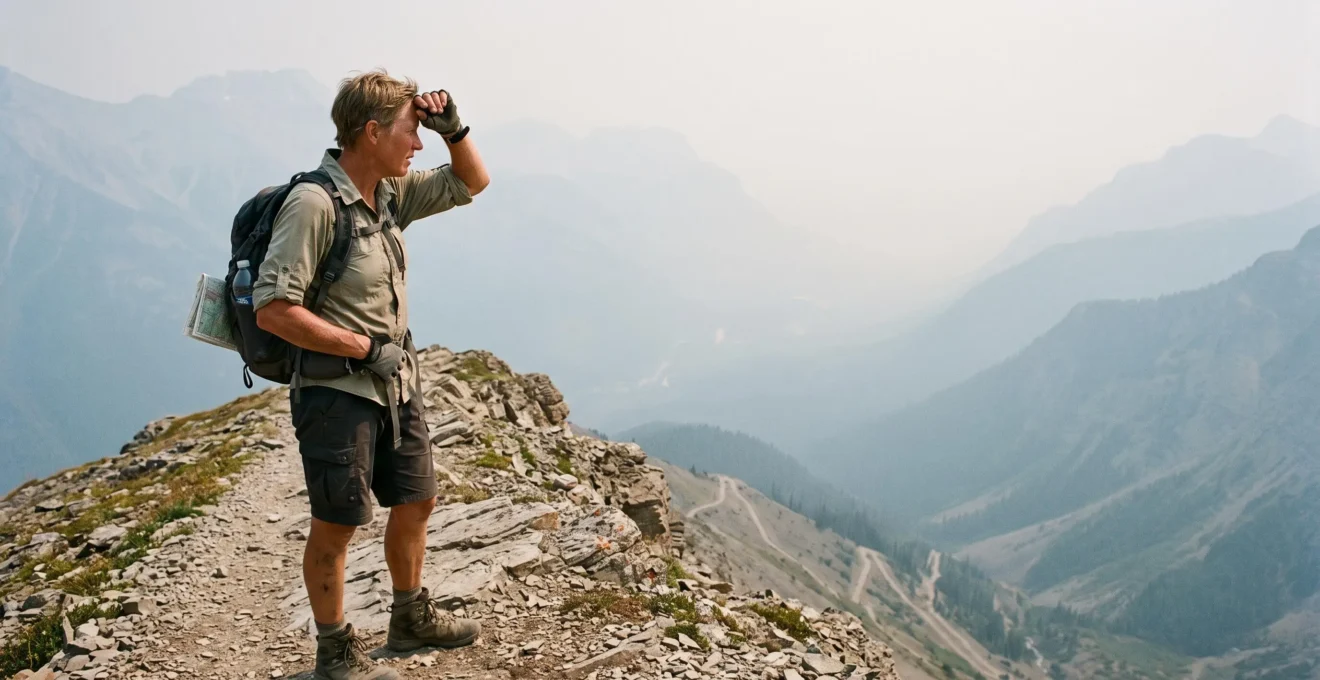
A summer hiking forecast of 24°C can look comfortable until the trail climbs through humid forest, the sun reaches an exposed slope, or wildfire smoke begins affecting your breathing. Across Canada, July and August hiking conditions can change the effort required for a familiar route without changing its published distance or difficulty rating.
For casual hikers and families, the safest approach is to plan around three separate questions: How much heat will the body experience? How healthy is the air? How difficult will the route become under those conditions? A short hike can still be demanding when humidity, elevation gain, direct sunlight and smoke exposure overlap.
Successful summer hiking does not require avoiding every warm day or mountain trail. It requires choosing a route that suits current conditions, checking air quality before leaving, starting early when appropriate, and establishing a turnaround point that everyone in the group can respect.
Summer hiking safety in Canada: the essentials
- Check Humidex and the Air Quality Health Index (AQHI), not just the forecast temperature or visibility.
- Choose shorter, less strenuous routes when heat, smoke or trail conditions increase the effort required.
- Start early when conditions allow, carry sufficient water, and turn around when symptoms, weather or air quality deteriorate.
- Why Can Summer Hiking in Canada Feel Brutal Even at 24°C?
- How to Plan a Summer Hike in Canada With a Start Time That Beats Heat and Crowds?
- Which Summer Trail Type Is Better in Canada: Forest Shade or Alpine Views?
- The Smoke Mistake That Turns a Summer Hike Into a Headache and Nausea Day
- When Should You Switch From Valley Hikes to Alpine Hikes in Canada’s Summer Season?
- Why Do Canadian Mountain Hikes Feel Harder Than the Distance Suggests?
- How to Choose the Right Level of Canadian Wilderness If You’re Not an Expert Camper?
- Which Canadian Mountain Peak Hike Is Realistic for Your Fitness Level Without Turning Risky?
Why Can Summer Hiking in Canada Feel Brutal Even at 24°C?
Summer hiking in Canada can feel exhausting at 24°C because humidity, direct sunlight, uphill effort and wildfire smoke create demands that the air temperature alone cannot describe. A shaded, level path may feel manageable, while an exposed climb at the same temperature can become uncomfortable much sooner. The key is to assess combined conditions rather than temperature alone.
Humidity is particularly important in southern Ontario, Manitoba and Quebec. When the air contains more moisture, sweat evaporates less effectively, making it harder for the body to cool itself during exercise.
Environment and Climate Change Canada‘s Humidex guidance illustrates the difference. At an air temperature of 24°C, a relative humidity of 65% corresponds to a Humidex of 29, while 80% relative humidity produces a Humidex of 32 Humidex.
24°C → Humidex 32
At 80% relative humidity, a seemingly moderate air temperature corresponds to a noticeably higher perceived-heat reading. Humidex does not directly account for climbing effort, sunlight or hiking equipment.
Environment and Climate Change Canada, Humidex reference table.
The agency recommends limiting or modifying outdoor exercise when Humidex readings exceed 30, according to individual circumstances and conditions. This is especially relevant to families whose youngest or least experienced member may struggle before the strongest hiker notices a problem.
Trail microclimates add another complication. A forest canopy reduces direct solar exposure, but a sheltered valley may have little cooling airflow. An open ridge can feel breezier while exposing hikers to uninterrupted sunshine. Neither setting guarantees better air quality during a wildfire-smoke event.
Smoke introduces an additional health consideration. Even when the temperature remains comfortable, elevated pollution may make sustained exertion inappropriate, particularly for children, older adults and people with respiratory or cardiovascular conditions.
A useful personal comparison is to revisit a familiar short route under different conditions. Record its duration, perceived effort, weather and, if already tracked, your usual heart-rate response. A substantially harder-feeling outing should prompt a reduction in pace or distance, even when the route has not changed. Heart rate alone cannot identify whether heat, dehydration, smoke or another factor explains the difference.
Recognizing those conditions early makes the next decision easier: selecting a departure time that reduces avoidable heat exposure without introducing new hazards.
How to Plan a Summer Hike in Canada With a Start Time That Beats Heat and Crowds?
The most practical summer hiking start time is usually early enough to complete the hardest climbing before the hottest part of the day, while leaving enough daylight for a safe return. However, dawn is not automatically the safest option. Air quality, trail access, weather warnings and the group’s ability to navigate in low light must all influence the decision.
Begin with the expected temperature pattern rather than a fixed departure hour. If the day’s warmest conditions are forecast for mid-afternoon, work backwards from when the group should be descending or finishing. Allow additional time for children, breaks, steep terrain and unexpected delays.
Then check access requirements. Popular locations in Banff, Jasper and Bruce Peninsula may have limited parking, controlled access or reservation requirements, depending on the trail and season. Do not assume that every trailhead has real-time parking information or uses the same booking system.
Use the relevant Parks Canada or provincial park website to confirm current access arrangements, trail conditions and closures. A reservation or parking entitlement does not establish that environmental conditions are safe.
Wildfire smoke requires a separate morning decision. The previous evening’s clear conditions do not guarantee clean air at sunrise, and an evening haze does not prove that the following morning will be equally smoky. Check the current AQHI, its forecast and available wildfire-smoke forecasts, including Environment and Climate Change Canada’s FireWork smoke modelling where applicable.
In the Canadian Rockies, the departure plan should also account for possible afternoon thunderstorms and exposed terrain. Establish a hard turnaround time before departure. A turnaround is a time to reverse direction regardless of whether the viewpoint or summit has been reached.
Five checks to complete before leaving for the trailhead
- Check the temperature and Humidex forecast; record the expected hottest period of your outing.
- Check the current AQHI and smoke forecast; write down your decision to proceed, shorten or postpone.
- Confirm trail status, access requirements and parking arrangements; save the relevant confirmation or park notice.
- Estimate the route duration with breaks and a safety margin; record a departure time and firm turnaround time.
- Check water, food, sun protection, navigation and your group’s readiness; complete a packing checklist and share the route and return plan with someone.
For a hypothetical family outing, an early departure might allow a gentle forest walk to finish before midday. But if the morning air quality is poor, an early start does not remove the smoke-related risk. The safer choice may be a shorter outing or an indoor activity.
Departure time reduces some risks, but the type of trail determines how much sun, shelter, elevation and exposure the group will encounter.
Which Summer Trail Type Is Better in Canada: Forest Shade or Alpine Views?
Neither forest shade nor alpine terrain is consistently better for summer hiking in Canada. Forest trails usually offer protection from direct sunlight, while open alpine routes may provide more airflow but greater exposure to sun, wind and sudden weather changes. During wildfire-smoke events, neither elevation nor tree cover guarantees cleaner air, so current conditions must decide.
A humid forest in southern Ontario may offer welcome shade while remaining uncomfortably warm during a climb. In the Rockies, a mountain ridge may feel cooler because of wind, yet expose hikers to stronger sunshine and less shelter if the weather deteriorates.
The choice becomes more complicated when wildfire smoke spreads across a region. Smoke concentration can vary with weather, elevation and local airflow. It is not reliable to assume that a dense forest below 2,000 metres is always cleaner than an exposed ridge, or that climbing above a smoky valley guarantees relief.
Instead, use the following comparison to identify the trade-offs.
| Condition | Shaded forest or valley | Open alpine route |
|---|---|---|
| Direct sunlight | Usually reduced beneath continuous canopy | Often substantial, with limited natural shade |
| Airflow | May be restricted in sheltered locations | Can be stronger, but increases wind exposure |
| Wildfire smoke | May accumulate or disperse depending on local weather | May improve or worsen with elevation and smoke movement |
| Footing | Roots, wet ground and uneven paths may slow progress | Loose rock, steep slopes or remaining snow may create hazards |
| Weather shelter | Canopy may reduce sun exposure but does not protect against lightning | Exposed ridges offer little shelter during storms |
| Family suitability | Often preferable when elevation gain and distance are modest | Requires careful assessment of terrain, experience and weather |
On a clear, comfortable day, a suitable alpine trail may be rewarding for hikers who have the necessary experience. On a hot day with strong sunshine, a gentle shaded trail may offer a more manageable outing. If smoke makes outdoor exertion inadvisable, changing trail type is not a dependable substitute for postponing the hike.
Canadian examples help illustrate the distinction. Gentle lower-elevation walks in Gatineau Park can provide forest cover, while routes such as Ha Ling near Canmore or the Skyline Trail in Jasper involve more exposed mountain environments and substantially different planning demands. Specific route conditions must be checked independently.
Altitude can also affect sun exposure. Higher-elevation hikes deserve particular attention to sunscreen, protective clothing, hydration and the availability of shade. A comfortable air temperature should not be mistaken for minimal UV exposure.
Once a suitable trail type has been identified, air quality remains a non-negotiable check, because the most consequential smoke-related mistake can happen before the first kilometre.
The Smoke Mistake That Turns a Summer Hike Into a Headache and Nausea Day
The common wildfire-smoke mistake is judging air quality by how clearly you can see the mountains. Fine particles may be present even when smoke is difficult to see or smell. Hikers who rely on visibility can continue climbing despite increasing exposure or emerging symptoms. Check air-quality health information and respond to symptoms, rather than waiting for the landscape to disappear behind haze.
Health Canada identifies fine particulate matter, known as PM2.5, as a major health concern associated with wildfire smoke. These particles are too small to see individually. Its guidance on wildfire-smoke health effects explains that air quality can be poor without visible or noticeable smoke.
Possible symptoms include headache, coughing, throat irritation and irritation of the eyes or nose. More serious symptoms can include wheezing, chest pain, shortness of breath, dizziness or heart palpitations.
Nausea or headache during a hot, smoky hike should never be dismissed as ordinary tiredness. These symptoms can have multiple causes, including heat illness, and cannot establish smoke exposure as the cause by themselves. Stop exertion, move to a safer environment when possible, and seek medical advice when symptoms are concerning or persist. Chest pain, marked breathing difficulty, confusion or collapse require urgent medical assistance.
Canada’s Air Quality Health Index helps hikers make decisions before symptoms develop. The official risk categories are more nuanced than a universal cancellation threshold.
| AQHI | Official health-risk category | Practical hiking decision |
|---|---|---|
| 1–3 | Low | Usual outdoor activities are generally appropriate, subject to heat, weather and personal health. |
| 4–6 | Moderate | Most people may continue usual activities unless symptoms occur; consider shorter, easier outings and additional precautions for at-risk hikers. |
| 7–10 | High | At-risk people should reduce or reschedule strenuous activity; everyone should reconsider strenuous hiking, particularly if symptoms occur. |
| Above 10 | Very high | Reduce or reschedule strenuous outdoor activity; at-risk people should avoid strenuous activity. |
These distinctions follow Canada’s official Air Quality Health Index risk categories. Children, older adults and people with relevant medical conditions may be more vulnerable and should follow the advice appropriate to their circumstances.
A family may choose an even more conservative approach, such as postponing a demanding route at AQHI 6. That is a precautionary planning choice, not an official rule requiring everyone to cancel at that reading.
After a smoke-affected outing, move to cleaner air, rest and address normal hydration needs. Do not assume drinking more water removes inhaled smoke particles. If symptoms continue or worsen, seek medical assessment. Before hiking again the next day, reassess air quality rather than assuming exposure has ended.
Once air quality is acceptable, the next seasonal question is whether gaining elevation provides a suitable hiking experience or introduces additional mountain hazards.
When Should You Switch From Valley Hikes to Alpine Hikes in Canada’s Summer Season?
Switch from valley hikes to alpine routes when the particular trail is sufficiently snow-free, weather conditions are stable, and your group has the skills for its terrain—not simply because July or August has arrived. Canada’s mountain regions do not share one alpine hiking calendar. Remaining snow, wildfire smoke, exposed ridges and storm forecasts can make a lower-elevation option more appropriate.
In the Canadian Rockies, higher trails can retain snow into early July or later, especially in shaded locations, gullies and north-facing terrain. Some coastal British Columbia routes may become accessible earlier, but their timing depends heavily on local elevation, snowpack and weather.
Do not interpret a snow-free trailhead as proof that the upper route is clear. Conditions can change substantially as elevation increases. Hard morning snow, slippery traverses or an exposed section above steep terrain may require equipment and skills that ordinary summer hikers do not possess.
Before switching to an alpine objective, consider four readiness questions:
- Snow and footing: Are remaining snowfields, frozen surfaces or loose sections within the group’s abilities?
- Weather: Is there a suitable window for reaching exposed terrain and returning before possible storms?
- Smoke: Do current air-quality information and forecasts support sustained outdoor exertion?
- Retreat: Can everyone safely turn back without needing to cross hazardous terrain or rely on unavailable transport?
Smoke can complicate the apparent benefits of elevation. Under some conditions, a valley may hold more smoke than higher terrain. Under others, smoke may extend over ridges and across entire mountain regions. An alpine climb should never be planned as a guaranteed escape into clean air.
The meaning of alpine hiking also differs geographically. In Alberta and British Columbia, it may involve high mountain passes and rocky ridges. In Quebec and Atlantic Canada, exposed summits and plateaus can create similar wind and weather challenges at different elevations.
The practical switch happens when route-specific evidence supports it: local trail reports indicate suitable conditions, the forecast provides an adequate return window, and the group is comfortable with the terrain.
Even when the season and weather are favourable, an alpine route can still demand much more effort than its published distance suggests.
Why Do Canadian Mountain Hikes Feel Harder Than the Distance Suggests?
Canadian mountain hikes often feel harder than their distance suggests because elevation gain, steep gradients and uneven terrain demand more effort and time than level walking. A 10 km route climbing 900 metres is not comparable to a flat 10 km walk. Summer heat and wildfire smoke can add further strain, making distance alone an inadequate measure of suitability.
When comparing trails, look for total cumulative elevation gain. This measures the uphill climbing across the route, including repeated climbs after descents. It gives a clearer indication of physical demands than the highest elevation alone.
For example, consider two hypothetical 10 km outings. One follows a mostly level lakeside path, while the other includes 900 metres of cumulative climbing. Even though the distance is identical, the second route involves much greater sustained uphill work.
Trail surfaces matter too. Roots, loose stones, rocky steps, steep sections and unstable scree can force hikers to slow down, maintain balance and place each foot carefully. Descending difficult terrain may also take longer than expected, especially when legs are tired.
Parks Canada‘s trail rating and description criteria explicitly account for factors such as elevation, gradient, terrain, current weather and trail conditions. Its published duration estimates generally describe average visitors under ideal conditions.
A useful planning method is to begin with your own walking pace on comparable terrain. Add an allowance for total climbing, technical sections, breaks and the return journey. A Naismith-style estimate can help structure the calculation, but no single formula reliably predicts every family’s mountain pace.
Heat and smoke should be treated as additional constraints, not small adjustments to a distance calculation. If a hike already approaches the group’s comfortable limit in good weather, adverse conditions are a reason to choose a shorter or easier alternative.
Consider how the slowest person performed on a recent outing involving similar elevation gain. That experience is more relevant than a general assumption that everyone can comfortably walk 10 km.
Understanding the true effort of a route also helps determine how far from roads, services and reliable communication a group should venture.
How to Choose the Right Level of Canadian Wilderness If You’re Not an Expert Camper?
Choose a Canadian wilderness experience according to your navigation, emergency and self-reliance skills—not fitness alone. Beginners usually benefit from serviced campgrounds and well-marked day hikes, while overnight backcountry routes demand more independent planning. Remote wilderness requires the ability to manage extended isolation and changing conditions. During severe heat or wildfire smoke, selecting a less remote setting provides more options for retreat.
A strong hiker may still be unprepared for a route without mobile reception, clear signage or quick access to assistance. Conversely, someone with moderate fitness and appropriate planning skills may be well suited to a short, managed backcountry overnight.
The following three-tier framework can help identify a realistic starting point.
| Wilderness level | Typical experience | Skills and precautions needed |
|---|---|---|
| Frontcountry | Serviced campgrounds and accessible, established day trails | Basic navigation, weather awareness, adequate supplies and an emergency plan; mobile coverage must still be verified. |
| Intermediate backcountry | Established overnight routes and designated or reserved campsites | Offline navigation, overnight equipment, water treatment, wildlife precautions and independent incident management. |
| Remote wilderness | Multi-day travel far from road access, potentially involving aircraft or other specialized access | Advanced navigation, communication planning, emergency preparedness, substantial self-reliance and appropriate experience. |
These tiers are a practical planning framework, not an official national classification. Facilities, connectivity, rescue access and permit arrangements differ among individual parks and routes.
Heat and smoke change the consequences of being remote. On a frontcountry trail, a group may be able to shorten its outing relatively quickly. Several hours into a backcountry route, reaching a safer environment may take much longer.
During significant heat or smoke events, an effective precaution is to step down one level of remoteness, or cancel when conditions make outdoor travel unsafe. This is a conservative decision rule rather than a universal Parks Canada requirement.
For a first overnight experience, investigate established backcountry sites with manageable approaches, current trail information and appropriate reservation arrangements. Guided trips, including options led by qualified ACMG-certified mountain guides where relevant, can provide structured opportunities to develop skills.
Wildlife awareness also belongs in the decision. Learn the precautions required in the specific region, including food storage and bear-safety practices where applicable. A hiking route’s apparent simplicity does not eliminate wilderness responsibilities.
With the appropriate level of remoteness established, the final question is which mountain objective fits demonstrated ability rather than ambition alone.
Key takeaways before choosing a Canadian mountain summit
- Use a recently completed hike with comparable elevation gain and terrain as the strongest evidence of readiness.
- Match technical exposure and navigation demands to proven skills, not general fitness or enthusiasm.
- Lower the difficulty of your objective when heat, smoke or unstable weather reduces your safety margin.
Which Canadian Mountain Peak Hike Is Realistic for Your Fitness Level Without Turning Risky?
A realistic Canadian mountain peak is one that matches your recent hiking experience, comfort with exposure and ability to return safely under current conditions. General fitness alone does not establish readiness for steep rock, loose terrain or navigation challenges. On hot or smoky days, choose an easier objective than you would attempt in clear, comfortable weather.
Begin with the most demanding comparable hike completed recently. Record its elevation gain, duration, terrain and how well you felt during the return. A peak requiring substantially more climbing or more difficult footing should not be treated as a routine next step.
Then assess exposure. A person may be physically capable of a long ascent while feeling uncomfortable on steep, narrow or rocky terrain where a slip could have serious consequences. Scrambling experience, route-finding ability and confidence on the descent are separate considerations.
Well-known Canadian mountain objectives illustrate why a simple beginner-to-expert ranking can be misleading.
| Objective | Planning level | Important considerations |
|---|---|---|
| Ha Ling Peak, Alberta | Demanding mountain day hike | Steep ascent, substantial climbing effort, exposed upper terrain and changing weather. |
| East End of Rundle, Alberta | Steep mountain objective requiring careful assessment | Loose terrain, sustained climbing and potentially challenging route conditions. |
| Mount Yamnuska, Alberta | Experienced mountain hikers and scramblers, depending on the route | Exposure, route-finding and scrambling hazards; not a suitable default beginner summit. |
| Mount Assiniboine area, British Columbia | Advanced trip planning for remote multi-day objectives | Access, remoteness, weather and overnight logistics. Hiking in the area is distinct from attempting the technical summit. |
These are illustrative planning distinctions, not verified current trail ratings or an authoritative ranking. Mount Assiniboine’s summit, in particular, is a technical mountaineering undertaking rather than an ordinary hiking peak. A destination’s suitability depends on the specific route and current conditions.
Before attempting any peak, identify a turnaround time and clear reasons to abandon the objective. Examples include developing thunderstorms, deteriorating smoke conditions, insufficient water, unexpected snow or terrain beyond the group’s capabilities.
Symptoms matter more than summit progress. New dizziness, unusual breathlessness, headache, nausea or confusion should prompt stopping and appropriate action, not pressure to continue. Potentially serious symptoms require urgent medical attention.
For families, the right summit may be a lower viewpoint or a shorter mountain trail with an enjoyable destination and a straightforward descent. The experience does not become less valuable because the group avoids a difficult final ridge.
For your next July or August hike, choose a route already within your group’s demonstrated abilities, verify the weather and AQHI shortly before departure, and agree on a turnaround point. The safest mountain objective is the one everyone can complete and return from comfortably—not necessarily the highest summit available.
Can children hike outside when the AQHI is moderate?
Canada classifies AQHI readings of 4–6 as moderate health risk. Children are among the populations that may be more susceptible to air pollution. Consider their health, symptoms and the intensity of the planned activity. An easy, short outing may be more appropriate than prolonged uphill exertion, and postponement may be preferable when conditions or individual vulnerabilities warrant it.
Does an N95 respirator make a smoky mountain hike safe?
A properly fitted, appropriate particulate respirator can help reduce inhalation of airborne particles, but it does not eliminate exposure or protect against every pollutant in wildfire smoke. Fit, comfort and breathing demands matter, particularly during strenuous exercise. A respirator should not be used to justify an otherwise unsafe hike; reducing exposure or changing plans remains important.
Can wildfire smoke make hiking unsafe even when the sky looks blue?
Yes. Fine particles associated with wildfire smoke may be present even when visibility appears good. Check air-quality health information rather than relying on the colour of the sky or whether smoke has an obvious smell.
What should you do if someone develops signs of heat illness on a hike?
Stop physical activity, move the person into shade or a cooler location, and begin cooling them. If they are alert and can swallow safely, offer water. Confusion, collapse, seizures or other signs of severe heat illness require emergency assistance and immediate cooling while help is arranged. Do not force fluids into someone with impaired consciousness.
Should you cancel a hike when wildfire-smoke forecasts disagree?
Conflicting forecasts indicate uncertainty rather than proof of safe conditions. Check the latest observed AQHI, official forecasts, local advisories and park notices before leaving. If a long or remote outing would leave little opportunity to retreat when air quality deteriorates, choosing a shorter route or postponing the hike provides a more conservative safety margin.