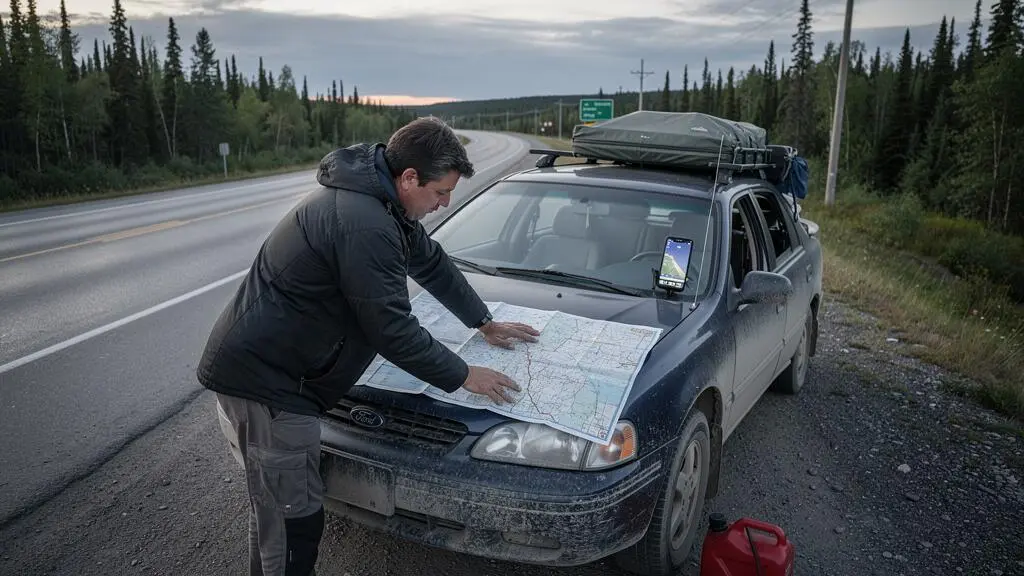
An 800 km driving day may look reasonable on a map of Canada. On the road, it can mean hours of sustained concentration, construction delays, unpredictable weather and long distances between dependable services. Repeat that schedule across several provinces, and a seemingly efficient itinerary can become exhausting and expensive.
A safer cross-Canada road trip begins with the distance a driver can comfortably manage, not the distance a navigation app suggests is technically possible. That means planning rest breaks separately from fuel stops, checking which communities can support an overnight stay, and leaving time for road closures without sacrificing sleep.
The challenge changes from Northern Ontario to the Prairies and the Rocky Mountains. A practical itinerary must account for those differences rather than applying one daily kilometre target everywhere. It should also recognize that train connections, ferries and outdoor excursions can introduce delays that cannot safely be recovered by driving faster.
Cross-Canada road trip essentials
- Set daily distances from tested personal driving capacity, with shorter days for unfamiliar, demanding or remote roads.
- Use approximately 250 km as an initial service-planning interval, then verify fuel availability, operating hours and backup stops.
- Budget for delays, review provincial road and wildfire reports, and protect overnight and transport connections with realistic buffers.
- Why Does Driving Across Canada Feel More Exhausting Than the Map Suggests?
- How to Build a Cross-Canada Driving Plan With Reliable Stops Every 250 km?
- Which Route Makes Sense for You: Trans-Canada Highway or Scenic Backroads?
- The Budget Trap That Can Add $700 CAD to a Cross-Canada Road Trip
- When Should You Drive Each Region of Canada to Avoid Snow Closures and Smoke?
- How to Plan Rail-to-Transit Connections in Canada Without Missing the Only Bus of the Day?
- How to Plan an Island Kayak Route in Canada With Bailout Beaches Every 30 Minutes?
- How to Build a Canada Trip Around Rail Routes Without Getting Stuck Between Stops
Why Does Driving Across Canada Feel More Exhausting Than the Map Suggests?
Driving across Canada feels more exhausting than a map suggests because distance is only one part of the workload. Long periods of concentration, repetitive scenery, weather changes, road construction and limited stopping opportunities can make a manageable-looking journey tiring. Consecutive long days also leave less time for sleep, recovery and unexpected delays.
A navigation estimate generally describes travel under assumed conditions. It does not fully capture the driver’s need to eat, walk, recover concentration, inspect the vehicle or respond to unexpected closures. On sections of the Trans-Canada Highway with one lane in each direction, slow vehicles and roadwork may also limit opportunities to maintain the expected pace.
Wildlife deserves particular attention around dawn and dusk. Extending a driving day into low light merely to reach a distant hotel can introduce a hazard that was absent from the original daytime plan. Time-zone changes also complicate arrival expectations: the clock may move forward or backward even though the driver has spent the same number of hours concentrating.
Two useful planning concepts are distance fatigue and monotony fatigue. These are practical descriptions rather than formal medical categories. Distance fatigue reflects the cumulative effort of prolonged driving. Monotony fatigue describes the concentration challenge of extended, visually repetitive travel, such as stretches of the Prairies or Northern Ontario.
Mountain driving can produce a different workload. Curves, grades, changing weather and frequent speed adjustments demand active attention. A short mountain segment may therefore require more recovery time than a longer, familiar highway segment.
Transport Canada’s road safety brochure recommends rest stops every 90 minutes, walking around when possible, obtaining adequate sleep and avoiding night driving where practical. Its advice is based on driver fatigue, not a universal daily kilometre limit.
90 minutes
Transport Canada’s recommended interval between rest stops. This is a time-based fatigue precaution, not a recommendation to drive a fixed number of kilometres.
Transport Canada, Road Safety in Canada — Improving Your Safety.
Before departure, measure your comfortable driving capacity on a familiar highway. Record actual time behind the wheel, rest breaks and how alert you feel at the end. Then choose a shorter target for unfamiliar roads. Any reduction factor is a personal planning allowance, not an officially validated safety formula.
For a hypothetical driver comfortable with 600 km on familiar roads, planning 450 km on a demanding day represents a deliberate 25% reduction. Another driver may need substantially less. The appropriate target depends on conditions, experience, rest and concentration.
Do not assume that a distance manageable on Day 1 will remain comfortable later. Fatigue can accumulate when long driving days reduce recovery opportunities. There is no established rule that Day 3 or Day 4 is necessarily the worst, so reassess alertness every morning.
Warning signs such as drifting within a lane, delayed braking or difficulty remembering recent kilometres mean that the day’s original distance target is no longer the priority. Stop safely and rest rather than relying on music, caffeine or determination to compensate for fatigue.
Once a reasonable driving-day limit is established, the next challenge is ensuring that fuel, rest and overnight options actually exist along the chosen route.
How to Build a Cross-Canada Driving Plan With Reliable Stops Every 250 km?
Build a cross-Canada stop plan by marking potential services roughly every 250 km, then adjusting that spacing to match the vehicle’s fuel range, road conditions, daylight and verified operating hours. The 250 km figure is a planning prompt, not a guaranteed service interval or safety standard. Every critical stop needs a workable alternative.
Begin by dividing the route into legs between communities with confirmed services. For each leg, record the actual distance, estimated travel time, expected fuel remaining and the next viable location if the planned stop cannot be used.
Classify potential stops into three practical categories:
- Fuel-only: A verified operating fuel outlet without an assumed accommodation or emergency-service capability.
- Overnight-capable: A community with confirmed lodging or an available campground, suitable for ending the driving day.
- Emergency-only: A possible refuge or stopping location whose facilities are limited, uncertain or unsuitable for a normal planned break.
This classification prevents a common planning mistake: treating a dot on the map as proof that fuel, food, accommodation and communications will all be available.
In remote parts of Northern Ontario, for example, weak cellular coverage and limited services can make a missed fuel stop more consequential. Similar verification is sensible wherever the chosen route passes through sparsely populated areas, including parts of the Prairies.
A useful resilience test is to consider what happens if one essential stop becomes unavailable. Before entering a remote leg, identify another viable fuel source and calculate whether the vehicle can reach it with a reasonable reserve. The alternative must be reachable without relying on the closed facility.
This is a planning method, not an official two-failure or fuel-reserve standard. If no satisfactory alternative exists, refuel earlier, revise the leg or postpone departure until availability can be confirmed.
For Ontario highways, Ontario 511’s explanation of road-condition reporting identifies how information about closures, incidents, construction and driving conditions is collected. It is useful for assessing road access, but it does not establish the operating status of every nearby private fuel station.
Confirm service hours directly with operators when a stop is essential, particularly outside peak travel periods. Also store offline maps and written distances so that a loss of mobile data does not remove the route plan.
Build a five-part stop verification sheet
- List each driving leg and its exact planned distance; produce a route table with start and end points.
- Record candidate stops around each 250 km planning interval; produce a marked map or spreadsheet.
- Classify each stop by available services and confirmed opening hours; produce a verified service column.
- Calculate reachable alternatives using realistic fuel range; produce a backup stop for every critical leg.
- Mark two or three places where a half-day delay can be absorbed; produce a revised overnight schedule with flexible bookings.
Position the delay buffers around the route’s least flexible sections, such as remote road stretches, mountain crossings or expensive reservations. A half-day reserve is most valuable where it prevents one disruption from affecting several subsequent bookings.
A reliable network of stops makes it possible to compare main highways and scenic alternatives on operational grounds rather than scenery alone.
Which Route Makes Sense for You: Trans-Canada Highway or Scenic Backroads?
The Trans-Canada Highway is usually the more straightforward starting point for a multi-province driving itinerary, while scenic backroads make sense when time, weather and verified services permit. Neither option is automatically faster, safer or cheaper everywhere. Compare each segment’s actual road characteristics, service availability and seasonal conditions before committing to the route.
The Trans-Canada connects major travel corridors across the country, making it a practical backbone for long-distance planning. However, it is not a uniform divided expressway: driving conditions vary considerably by province and section.
Scenic alternatives can provide meaningful stops and quieter landscapes, but the cost may be longer travel time, lower service density or exposure to different road hazards. Gravel surfaces, limited passing opportunities and slower speeds can make a short-looking detour significantly more demanding than expected.
The following comparison is a decision framework, not a nationwide statistical ranking.
| Criterion | Trans-Canada Highway | Scenic backroads |
|---|---|---|
| Fuel and services | Established highway corridor; verify gaps on each section. | Services may be less frequent; confirm every essential stop. |
| Cell coverage | Can be unreliable in remote sections. | May also have substantial gaps; offline navigation is important. |
| Seasonal reliability | Subject to construction, storms, collisions and closures. | Some routes have additional seasonal restrictions or maintenance limitations. |
| Total driving days | Useful baseline for estimating transfer days. | May require more time because of detours and lower average speeds. |
For example, a traveller crossing Ontario could use the main highway for the longer transfer days and reserve a shorter day for a verified lakeside detour. The detour is worthwhile only if the actual return distance, road condition and availability of accommodation fit the remaining daylight and driving capacity.
A hybrid itinerary often offers the best operational flexibility: use the established corridor for essential travel, then select scenic deviations that can be shortened or cancelled without disrupting the next overnight stop.
Travel month matters as much as road choice. Mountain routes, seasonal attractions and some ferry connections have operating constraints that cannot be resolved by simply choosing a different navigation setting.
Check road restrictions and ferry schedules before booking accommodation around a scenic section. If the weather changes, maintain a verified alternative rather than assuming the backroad will remain passable.
Once the route is chosen, its less obvious costs become clearer, including extra fuel, unplanned accommodation and cancellation exposure.
The Budget Trap That Can Add $700 CAD to a Cross-Canada Road Trip
A cross-Canada road trip can incur an additional $700 CAD in a plausible hypothetical scenario involving an unplanned hotel stay, higher fuel costs and a changed ferry booking. This amount is an illustration, not a verified national average. The real financial exposure depends on the route, vehicle, season and conditions attached to reservations.
Distance creates two separate fuel costs. The first is consumption: additional kilometres require additional litres. The second is the price paid per litre, which can vary between urban centres and more isolated service locations. A shorter route does not automatically produce the lowest total expense if it introduces costly detours or service limitations.
Use the vehicle’s realistic consumption and the chosen route’s kilometres to estimate fuel needs:
Fuel cost = distance in km × consumption in L/100 km ÷ 100 × price in CAD/L.
For a purely illustrative budget, consider a trip where one disruption creates the following extra expenses:
Hypothetical example: $700 CAD in unexpected costs
A weather-related delay forces the traveller to add an overnight stay budgeted at $220 CAD. A revised route and more expensive refuelling add an estimated $130 CAD. A changed ferry reservation and associated travel adjustments contribute a further assumed $350 CAD.
The resulting scenario totals $700 CAD. These are invented budgeting inputs for illustration, not observed market prices, typical ferry charges or a forecast of what most travellers will spend.
The more damaging problem can be the cancellation-cost chain. One delayed driving day may affect a non-refundable hotel, a campground reservation and a transport departure scheduled for the following morning.
Refundable accommodation provides flexibility but may have a higher initial booking price. Travel insurance can sometimes address specified disruption events, but coverage, exclusions, documentation requirements and reimbursement limits vary by policy. Neither approach guarantees that every weather-related change will be compensated.
A practical contingency fund should reflect the two most expensive credible failure points on the specific itinerary, rather than rely entirely on a fixed percentage of total spending. For one route, those might be a remote overnight stay and a missed ferry. For another, they could be additional rental-vehicle days and rebooked accommodation.
Write down the cost of each scenario, including taxes and applicable cancellation fees. This exposes risks before they become urgent decisions at the roadside.
Weather is often the trigger that turns these possible expenses into real ones, making regional travel timing the next critical decision.
When Should You Drive Each Region of Canada to Avoid Snow Closures and Smoke?
There is no single month that guarantees snow-free roads and smoke-free skies across Canada. Atlantic Canada, Ontario and Quebec, the Prairies, the Rocky Mountains and British Columbia face different seasonal hazards. Plan the travel window region by region, then check current forecasts, road restrictions and wildfire information throughout the journey.
Summer generally avoids many winter-driving difficulties, but it does not eliminate wildfire smoke, road construction or sudden mountain weather changes. Spring and autumn can offer different travel conditions while introducing risks from freeze-thaw damage, early snowfall or shortened daylight.
The following regional guide identifies hazards to investigate rather than predicting fixed closure dates.
| Region | Conditions to investigate | Planning response |
|---|---|---|
| Atlantic Canada | Winter storms, spring road conditions and coastal weather. | Check highway reports and ferry requirements where relevant. |
| Quebec and Ontario | Snow and ice, spring road damage, construction and wildfire smoke. | Review provincial road alerts and allow time for remote stretches. |
| Prairies | Winter storms, strong winds, visibility restrictions and wildfire smoke. | Keep alternative overnight stops and reassess travel before long exposed sections. |
| Rocky Mountains | Mountain snowfall, rapidly changing conditions, closures and wildfire impacts. | Confirm road restrictions and build substantial schedule flexibility. |
| British Columbia | Mountain weather, wildfire smoke, road disruptions and seasonal route limitations. | Check provincial highway and emergency information before each major leg. |
Wildfire smoke must be treated as both a health concern and a possible travel disruption. Reduced visibility may complicate driving, while fires and emergency responses can affect highway access independently of local air-quality readings.
The Government of Canada’s wildfire-smoke travel guidance warns that conditions can change substantially from hour to hour. It recommends monitoring air-quality information, local warnings, alerts and evacuation orders, and being prepared to cancel travel when necessary.
Direction also affects the seasonal schedule. An east-to-west trip and a west-to-east trip starting on the same date reach the Rockies or Atlantic provinces at different points in the travel period. Compare those arrival dates against the relevant regional conditions, rather than assuming one compass direction is universally safer.
Before departure, review the applicable provincial 511 or equivalent road-information services, Environment and Climate Change Canada weather alerts, wildfire and emergency notices, and any Parks Canada closure information relevant to the itinerary.
Repeat those checks before each driving day. A closure, evacuation direction or warning of conditions beyond the driver’s and vehicle’s capabilities is a reason to change or postpone the leg. A forecast showing a credible major hazard should prompt a decision before entering a remote section, not a plan to reassess only after reaching it.
When road conditions make a long drive unattractive, a rail segment may offer an alternative, but connections to local transport require their own risk assessment.
How to Plan Rail-to-Transit Connections in Canada Without Missing the Only Bus of the Day?
To protect a rail-to-bus connection in Canada, verify the actual operating days of both services and avoid treating a low-frequency bus as an ordinary same-day transfer. Where the onward service runs only once daily, plan a protected overnight connection or another substantial buffer. Separate bookings may leave the traveller responsible for disruption costs.
Regional transportation services across Canada do not necessarily operate at the frequencies familiar from large urban networks. Depending on the location and operator, a bus may run daily, only on selected weekdays or less frequently.
That distinction changes the meaning of a missed connection. Missing a frequent urban bus may produce a minor delay. Missing the only scheduled regional departure can mean an unplanned hotel night, changed accommodation arrangements or an alternative journey at additional expense.
A useful rule is to protect one complete service cycle when an unreliable or long-distance train arrival feeds an essential low-frequency bus. If the bus runs daily, this may mean arriving the previous day. If it operates only on selected days, a longer buffer could be necessary.
This is a conservative itinerary design method, not a guaranteed connection policy. Actual train and bus punctuality, operator arrangements and the consequences of missing a departure must be verified independently.
VIA Rail and regional transport operators may use separate reservation systems. Unless an explicitly protected connecting itinerary is offered, travellers should not assume that one company will rebook travel purchased from another company after a delay.
Check each operator’s official timetable for the exact travel date. An aggregator may display a route without making seasonal suspensions, operating-day limitations or booking restrictions sufficiently clear.
Before purchasing tickets, calculate the practical cost of a missed connection: accommodation, transportation to an alternative departure point, missed campsite reservations and any vehicle-rental charges. Also confirm how passengers and luggage can move between the rail station and bus stop.
That same principle applies when adding optional activities to a cross-country journey: a schedule only remains resilient if weather-dependent excursions do not consume the travel time reserved for essential connections.
How to Plan an Island Kayak Route in Canada With Bailout Beaches Every 30 Minutes?
Plan island kayak bailout points around realistic travel time, landing safety and local marine conditions rather than assuming a beach every 30 minutes is always achievable. Wind, currents, tides and cold water can make a seemingly accessible landing unusable. Each proposed escape point must be evaluated for the conditions expected during the actual paddling window.
A half-hour spacing target can help organize an initial route sketch, but distance on the chart is not enough. A simple illustrative calculation multiplies realistic paddling speed by time.
For example, at an assumed effective speed of 4 km/h, 30 minutes corresponds to approximately 2 km. That arithmetic is a planning illustration, not evidence that the kayak can maintain that speed against wind or current, or safely reach a beach within that time.
Currents can change speed over the ground and may alter the kayak’s heading. Strong wind can make a planned crossing more difficult, while waves can prevent a safe landing even on an apparently sheltered shoreline.
Landing accessibility deserves separate verification. A beach visible on a map may be rocky, exposed to surf, bordered by shallow water or unsuitable at a particular tide level.
For Gwaii Haanas in British Columbia, Parks Canada’s marine-hazards information identifies tidal variations exceeding 7 metres, currents reaching up to 5 knots in Houston Stewart Channel, and shallow or rocky approaches in some areas. These are location-specific hazards, not general conditions for every Canadian island kayaking route.
Local marine forecasts, tidal predictions and route-specific navigation information should therefore guide launch and landing decisions. Parks Canada’s guidance for Gwaii Haanas also warns against kayaking in strong winds or when whitecaps are visible.
A practical go/no-go assessment should consider:
- Forecast winds and gusts relative to the paddlers’ demonstrated abilities.
- Wave conditions, tidal currents and exposed crossings.
- Cold-water immersion risks and appropriate protective equipment.
- Confirmed landing options, with alternatives if a preferred beach is unusable.
- Communication and emergency arrangements independent of assumed cellular coverage.
There is no single numerical wind threshold suitable for all kayakers, vessels and locations. If the forecast exceeds the group’s demonstrated abilities or safe landing cannot be reasonably established, convert the day into a shore day.
For a road trip, the essential consequence is schedule flexibility. A coastal paddling excursion may require additional weather days, which should not be recovered through rushed driving afterwards. Place these activities before a flexible overnight stay rather than immediately ahead of a non-refundable long-distance connection.
Once optional excursions have realistic weather buffers, rail and road transport can be combined into a broader itinerary without relying on optimistic connections.
Key takeaways before building a multimodal itinerary
- Every essential train, coach or driving segment should have a verified operating date and a realistic fallback.
- Low-frequency transport and weather-dependent activities require more schedule protection than ordinary short-distance transfers.
- Accommodation should be positioned around dependable arrival opportunities, not merely the shortest route between attractions.
How to Build a Canada Trip Around Rail Routes Without Getting Stuck Between Stops
Build a rail-centred Canada itinerary by identifying which long-distance journeys are actually served by passenger trains, then arranging road or coach connections for destinations outside those corridors. Verify service frequency before choosing overnight stops. A train journey can replace tiring driving days, but infrequent departures make missed connections and unsuitable stopping points important risks.
Canada’s passenger rail network is not a comprehensive alternative to the national road network. Services are concentrated in particular corridors and long-distance routes, while many communities and attractions require another form of transportation.
Start with the major destinations, not the railway map alone. For each location, establish whether a usable passenger rail station exists, whether the desired train operates on the relevant date and how the traveller will reach accommodation or onward transport.
A simple route audit should distinguish three types of segments:
- Rail-feasible: Confirmed passenger service with departure dates compatible with the itinerary.
- Road or coach required: A destination or transfer not adequately served by the intended rail itinerary.
- Single-thread connection: A segment where missing one departure could prevent onward travel that day.
Long-distance rail can be particularly attractive when it replaces several demanding driving days. However, its schedule may include inconvenient arrival times, limited departure frequency or stops that are unsuitable as overnight bases.
For example, a traveller could design an itinerary around a long-distance train between major cities and arrange shorter road excursions from suitable stopping points. The feasibility of that plan depends on current service dates, whether the train permits the intended boarding and alighting arrangements, and available local transport.
Do not assume that every station shown on a route map is a practical tourism base. Before selecting an overnight stop, confirm usable accommodation, ground transport, station access and the next train departure.
The booking order matters. First verify train schedules and the permitted boarding arrangements. Then identify dependable connections, reserve accommodation around actual arrival dates and keep flexible time around low-frequency services.
Calculate the cost and operational consequences of any missed onward segment. An overnight buffer may appear inefficient compared with an immediate transfer, but it can reduce the risk of losing several subsequent bookings.
Combining rail and driving also changes the fatigue budget. Replacing a long driving section with rail travel may create more time for rest, but it does not remove the need to plan safe driving limits for the remaining road segments.
Build the final itinerary as a day-by-day schedule showing confirmed transport, realistic driving distances, rest periods, overnight options and fallback arrangements. Only then commit to the least flexible bookings.
Is driving 800 km in one day always too much in Canada?
No universal kilometre limit establishes whether an 800 km day is safe for every driver. The appropriate distance depends on alertness, sleep, road conditions, experience and opportunities to rest. Rather than treating 800 km as normal, test personal capacity and plan shorter days when conditions are unfamiliar or demanding.
Should fuel stops always be scheduled exactly 250 km apart?
No. The 250 km interval is an initial planning tool, not a guarantee that services exist at those distances. Confirm station availability, fuel range and alternative refuelling locations. Rest breaks may need to occur much sooner than the next fuel stop, in line with fatigue guidance and the driver’s condition.
What should travellers do if wildfire smoke develops during the trip?
Check official air-quality reports, provincial road conditions, local emergency alerts and evacuation instructions. Conditions may change rapidly. Adjust or cancel travel when necessary, and do not assume that acceptable air-quality readings mean every affected highway remains accessible.
How much emergency money should a cross-Canada road trip include?
There is no universally appropriate amount. Calculate the cost of the two most expensive plausible disruptions on your route, such as an additional remote hotel night, delayed vehicle rental return or missed ferry. The $700 CAD example in this guide is hypothetical and should not replace an itinerary-specific calculation.
Can a cross-Canada trip combine trains, buses and rental cars?
Yes, provided each segment is independently verified. Confirm actual train and regional bus operating dates, rental availability, station access and the consequences of delays. Where separate operators do not provide a protected connection, an overnight buffer can make the itinerary more resilient.